This trail, along what is known as the Grand Canyon of Pennsylvania, or the Pine Creek Gorge, is a 30.5 mile trail known among backpackers as one of the best hiking trails in Pennsylvania. Pine Creek Gorge is a unique formation, formed recently in geological time. Pine Creek had a north-east course until 20,000 years ago when debris from the Laurentide Glacier dammed it up. A lake formed near Ansonia, at the north end of today’s Pine Creek Gorge. As the water overflowed the debris, it drained southward, flowing to the West Fork of the Susquehanna River, and forming the gorge. Early natives of this area used the route of the river for land and water routes, and the surrounding mountains for hunting.
This part of Pennsylvania had forests of eastern hemlock, pine and various tall, straight hardwoods. From the early 19th century to the early 20th century, the trees of this area were harvested for ship building, houses, furniture, shingles, tannins, fuel and myriad other uses. Pine Creek provided the waterway to float the harvested logs down river, past Williamsport and Harrisburg, then on to the Chesapeake Bay and Baltimore. The result of this incredibly rigorous industry was the total stripping bare of the hillsides, leaving tree stumps, dried out tree tops, and dry ground. Fires and floods followed. Wildlife left. Also remaining were rough logging roads no longer needed. These were later used as part of the trail today known as the West Rim Trail. A rail line built in the early 1880’s along Pine Creek, originally part of the Jersey Shore (a town in Pennsylvania), Pine Creek and Buffalo Railway, later called the Pine Creek Railway, transported lumber, coal and passengers along Pine Creek. It made its last run October 7, 1988, as part of Conrail. The track was later removed and the trail became a “rail trail” along Pine Creek now used for cycling.
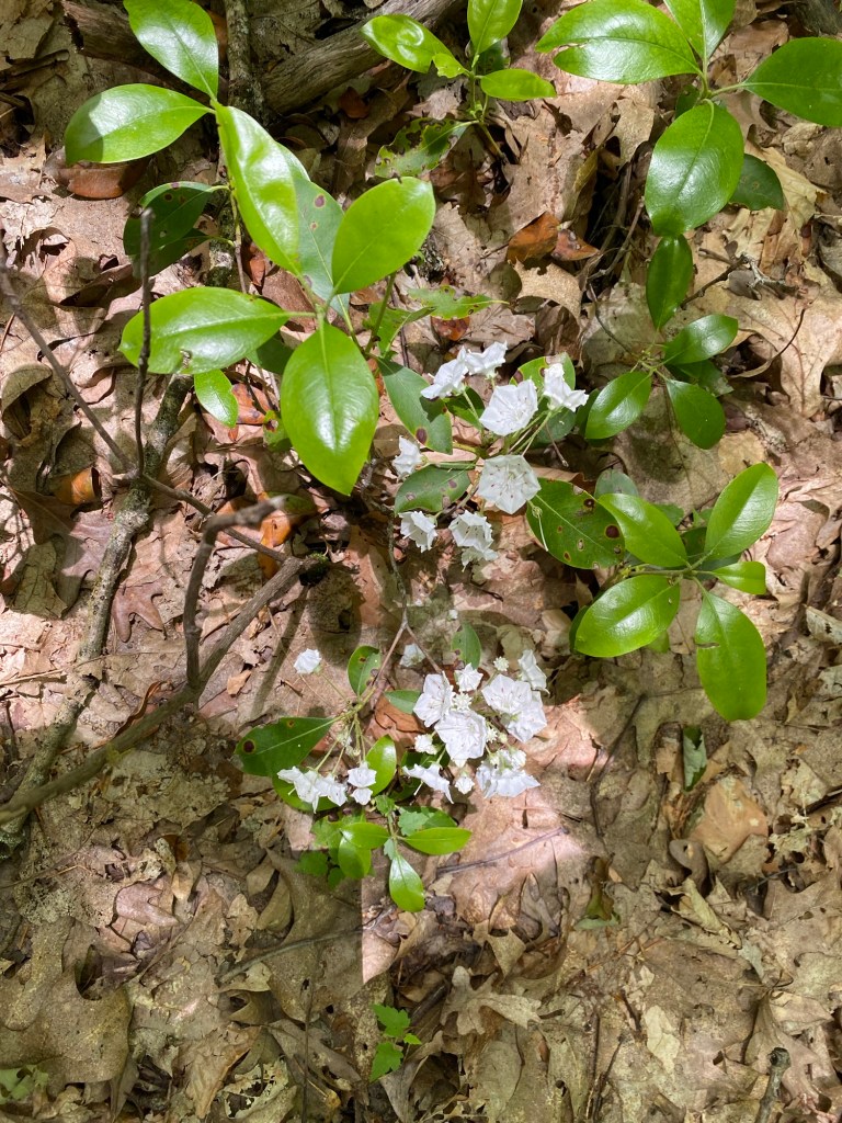
The recovery of life, flora and fauna, of the mountains of the Pine Creek Gorge began in the 1910’s. It started with mountain laurel and blueberries. Restoration continued with a variety of hemlock, pine and hardwoods. JThe area is now a somewhat protected area as Colton Point State Park, named for Henry Colton, a lumberman from the late 1800’s and the larger Tioga State Forest.

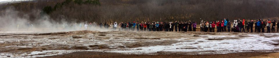
I have wanted to do this hike since I first heard of it from a friend at work years ago. Known as the Grand Canyon of Pennsylvania since 1936, when businessmen of Wellsboro started promoting it as a tourist destination, it was recommended to me as an ultimate backpacking experience. With the good company of my backpacking friends, Christine and Michele, we headed up for a planned 3 night 4 day hike on Saturday, June 15, 2024. Many will do this hike in one or two nights, but we wanted to have more time on the trail and in camp, and enjoy our time there.

We stopped in Williamsport Saturday night and stayed at the Genetti Hotel. We began that evening at New Trail Brewery, one of the best in Pennsylvania, and had dinner at the Bullfrog Cafe. The next morning, after a fortifying breakfast at the hotel, we drove up to Rattlesnake Rock, for our pick up. We were being picked up by Pine Creek Outfitters and driven to the northern end to start our hike. Our car would be waiting for as at the end of our trek. Of note there is no cell service there.


We joined several others in the van, all cycling the path along the river, for our drive north. Our packs were piled in the front passenger side, and we sat together in the second seat, quizzing the driver about the weather. It was predicted we would have a decent first day, then a major heat and humidity bubble would envelope the area the following day. Our driver did not give us the answer we wanted. He said being up on the trail would not be much different than the weather in Ansonia, with highs predicted in the 90’s.
We were dropped off with our packs and poles and the van left. There was nothing to do but get started on the trail and work our way to the end. It is an interesting feeling, knowing you are relying only on yourself and your companions to get to the southern end.

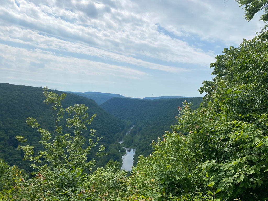
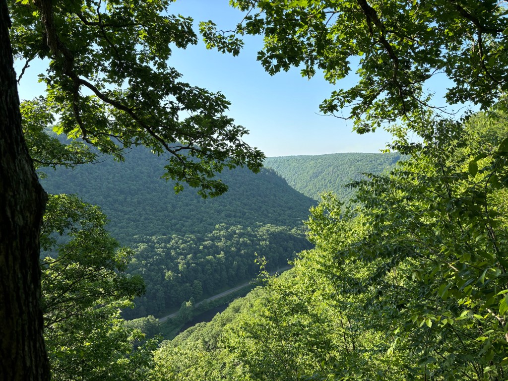
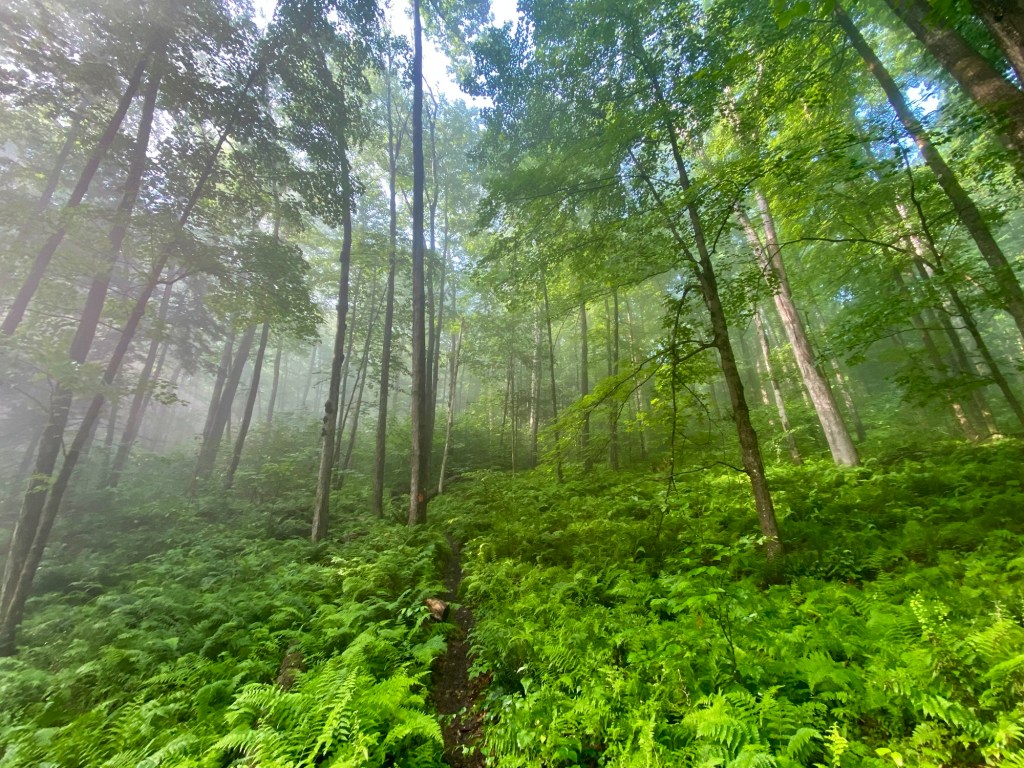
The trail starts with a long uphill trek to the rim of the gorge. It is close to 900 feet up. Once up to the rim, the trail goes up and down, and weaves along and away from the rim. At times the trail skirts the margins of the rim, providing occasional spectacular views of the gorge, but also plummeting drops on one side of a rocky and narrow trail.
For our first night, we stopped at a campsite near the rim at the 11 mile mark. It was a nice campsite, but had no water close by, so we needed to pack in water.

The next day got very warm and humid. We skipped our usual morning campfire and got on the trail fairly early to try to get to camp before it got too hot. Our trail map, which we purchased from Into the Backcountry, was very helpful in pointing out campsites, reliable water sources and seasonal water sources. Since we saw that some of the seasonal water sources had dried up, we needed to plan the route carefully. Due to extreme heat and humidity, we would need to adjust for water availability. So, our second day, while only 7 miles, seemed very tough and we were grateful for the trickling stream we found at mile 17. Along the way, we stopped at the Bradley Wales picnic area for a rest and lunch. There was a hand operated water pump there. But a posted sign said it went down 250 feet, and while it would provide water, about 15 minutes of pumping was needed to bring the water up. Since the pump was out in the sun, and the day had gotten quite hot, we skipped trying to get pump water.
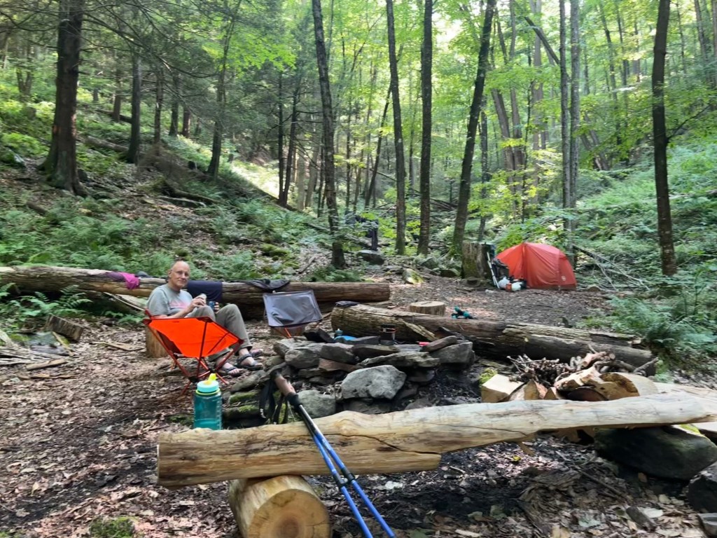
We made camp at mile 18, along the trail but only a few hundred yards off a gravel road. It was next to a beaver pond and near a water source on the other side of the road. It was a muggy area, but nice enough. The next leg would take us a long way without reliable water, so we were satisfied. After camp was set up, we started a fire mainly to keep away the gnats and flies. We had dinner, and were relaxing when we started to hear thunder in the distance. Michele’s Garmin InReach Mini 2, gave us a weather report stating the chance of rain was 4% and the expected amount under 0.1”. But the storm clouds were coming for us. Around 9:30 some drops were falling. We closed up our food supplies, hung our bear bag and got in our tents. By 10:00, a violent thunderstorm was passing directly over us, with heavy rain and no time between brilliant cracks of lightning and explosive thunderclaps. The rain seemed to ease up in a half hour, only to get heavy again, with more lightning very close by. We checked with each other to be sure we were all okay. The storm passed us for good by around midnight. Early the next morning we were up, our tents standing us in good stead.

Our next day’s plan was to get to a campsite at the 27 mile mark. While again, not long miles, with the heat, humidity and climbing, we figured it would be a challenge. We loaded up with water, filling our drinking bottles and also carrying an extra liter of water each in a dirty water bag, to be filtered along the way. Michele and Christine allowed me more frequent breaks than they needed, as I was sweating a lot and getting fatigued on the climbs. As it turned out, a couple of seasonal water sources were flowing with sparkling, cold, clear water. We happily stopped, filtered some more and headed on.
The trail varies from narrow, rocky, challenging paths, to long stretches through heavy growths of fern and stinging nettle. We had on long pants to keep the nettle from irritating us. I happened to have a brush of it on my lips and tongue. This caused about 15-20 minutes of numbness and tingling of these parts. It was an interesting experiment, though not on purpose.
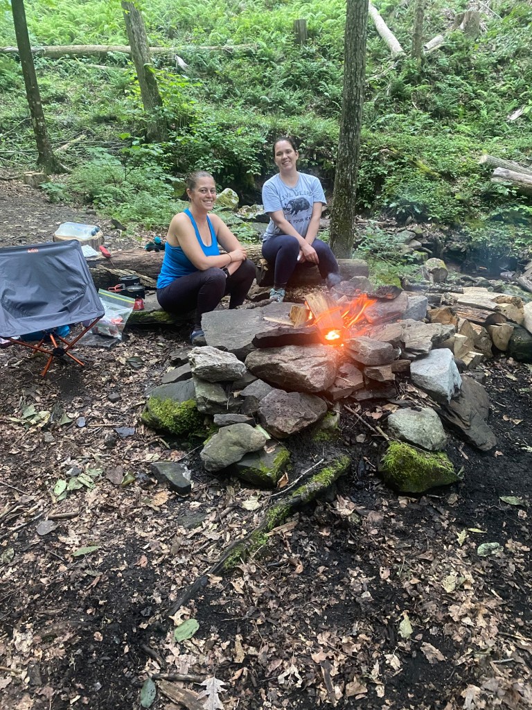
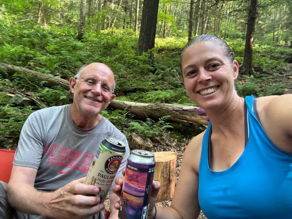
Christine was picturing our next campsite to be the best of all, good fire ring, running stream in which we could cool off plus have the pleasant sound of running water as we slept. While I was skeptical, she pretty much got what she was hoping for. At mile 26.5 a stream flows down through a side canyon, creating a little pool near the campsite. After setting up camp, we stripped to essentials and one by one got into the little pool to wash away the accumulated sweat and grime. It was very refreshing. Christine brought the instant ingredients for rice, bean and vegetable burritos which we had for dinner. We had cooled cans of beer in the creek. So, at Bohen Run we had a bath, burritos, beer and a babbling brook. Bliss!
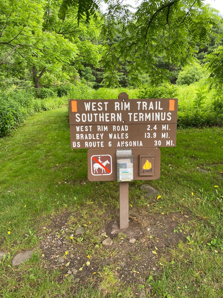
The last day was our short hike day. Knowing well that other backpackers would not want to take 4 days and 3 nights to complete this hike, our desire was to camp 3 nights and get a good feel for the trail and its history. The last 4 miles were relatively easy, 1.5 miles uphill, 1 mile flat and 1.5 miles down about 900 feet to Rattlesnake Rock, southern terminus of the trail and where our car was parked. We arrived a bit bedraggled but in good spirits. And, as we end all our backpacking trips, we headed to Taco Bell to satisfy a hunger craving.

While this is an iconic trail, and well worth the trip, I probably would not go back and repeat it for a while. The scenic views were nice, but many were obscured by overgrown brush. Hiking along a very narrow trail with a steep drop on one side is challenging, but means one is always looking down rather than being able to glance at the scenery. The heat and humidity, and the constant buzzing of gnats around my ears and eyes influenced my opinion, I’m sure. So maybe if a friend were to say they were doing this hike in April or May, want to join me, I’d likely say yes.
Sources used for history and trail descriptions:
https://trails.dcnr.pa.gov/trails/trail/trailview?trailkey=215
https://en.wikipedia.org/wiki/Pine_Creek_Gorge
https://www.dcnr.pa.gov/StateForests/FindAForest/Tioga/Pages/Wild_NaturalAreas.aspx
