
Reynisdrangar, basalt columns off the coast at Vik í Mýrdal in southern central Iceland
Reynisdrangar. Right off the water’s edge from Reynisfjall. Two trolls were pulling their three-masted boat in, but it was slow going because of the rough seas. Unfortunately, they got caught out in the water as the sun rose, and being trolls, this turned them to stone. And, there they stay, out in the water, forever.
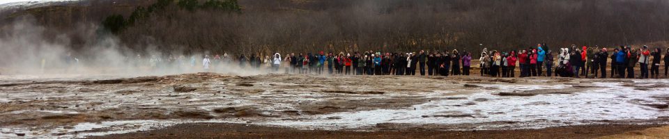
Vik is not a large town. In fact, only about 300 people live here full-time. This was our next destination on our tour of Iceland. We left our cozy little cabin near Selfoss, put some diesel in the Skoda, and headed out along Iceland 1, the ring road that runs the circumference of Iceland. Along the way, passing through Hvolsvöllur, we happened to see a sign on the road for the “The Saga Centre”. As we drove by the sign, I asked my traveling companions if they would like to stop and check it out. Yes, was the reply. So, we turned around and searched for it. It was not immediately obvious, but hunting off the main road took us to the low building with a painting of a viking ship, vikings with swords raised, on the side, and there we were.

The Saga Centre
Inside, a very nice woman explained the exhibit. We paid the entrance fee and explored. The Centre is devoted to telling the story of Njáls Saga, or the Story of Burnt Njáll. Yes, Njáll meets an unpleasant end, but a lot happens in this, the most famous and one of the earliest of the Icelandic sagas. It is a story first written down by an unknown author between 1270 and 1290, but taken from oral stories of early families, mainly concerning the sagacious Njáll and his friend the strong warrior Gunnar. It is a long and complicated work. The museum shows the saga from start to finish in dioramas with life-sized figures, dressed in period garb, with the writing in Icelandic and English, and allow for an understanding of the flow of the saga, the feuds, the insults, the vengeance, the trickery, the lustiness and the struggles of every day life in early, Viking-style Iceland. After making our way through Njáls Saga, we moved to the mock-up of a Chieftain’s Hall, a meeting area built by the Vikings in early times.

Viking-era Chieftain’s Hall at the Saga Centre.
Today, it is used as a café, and is rented out for functions. Beyond this, was another hall in which there was an intriguing project taking place. It is called the Njals Saga Tapestry, and it is the work of three women who designed and created a 90 meter long tapestry in which panels depict the entire story of Njáls Saga. It uses a Bayeux stitch, which was a type of tapestry stitch used in Viking times. According to Christína, one of the creators of the project, 60 meters have been completed so far. She is not certain where such a big artwork will be displayed.

Christína and her Njáls Saga Tapestry

One of the panels of the tapestry. The pinned papers show the name of the person working on that panel.
Once we had finished contemplating life in the time of Njáll, we sat outside and ate sandwiches we had prepared that AM. It started out sunny and warm, but had turned cold and overcast, so we hurriedly finished and then went on driving towards Vik. One thing in Iceland one can count on is the presence of waterfalls. Our next stop was at Seljalandsfoss, where water from the above plain and glacier plunge 60 meters to the flat land below. A unique feature of this waterfall, is the footpath that leads behind it to a cavernous space from which one can witness the backside of water. I came prepared for this. I wore my waterproof jacket and ski pants, had my hiking boots on, and kept my camera under my jacket until I got around to the back. There was a good breeze blowing, spraying water over the path which made it slippery. I managed the path, and had a big grin on my face once I got to the relative protection of the cave.

Seljalandsfoss from the front.

Seljalandsfoss from behind (the backside of water).
A bit of a hike down the path was another waterfall, Gljúfrabú¡, also very dramatic, and hidden behind an opening in the cliff.

Gljúfrabú¡, the hidden falls near Seljalandsfoss

A sheep carcass along the path, in its “pre-fossilized” state.

Kathleen and Lynne, walking along the runoff from the falls.

The big picture view of the Seljalandsfoss area.
We then went on to Vik, and to our next Airbnb rental. As we neared Vik, we climbed over a mountainous pass which then descended into the town. It is a tiny town, with a population around 300. But, being the only town of any size in this area, it is well stocked. There is a nice grocery, a bank, and a liquor store. Our rental was easy to find, as it was right off the main highway, and looked just like its photo on the website. Once we made it into the apartment, we headed on foot to the store to gather up some wine, beer and hors d’oeuvres. Our whole group of nine intrepid explorers were coming over to our place to eat, drink and chat about what we had seen and done so far.

Frank, Lynne, Bob, Gary, Niny, Kathleen, Michael, Sue and Ann; in Vik.
We prepared some Icelandic crustaceans similar to crayfish with seafood sauce, had locally produced salami and cheeses, and Kathleen made a delicious yellow split pea soup for some honest sustenance. Grapes and Finncrisps topped off the delights. There was no need for dinner that evening.
Overnight, it snowed. According to one source, Icelandic language has 100 names for snow. Snow is certainly part of their culture. It made for a difficult drive the next morning. While the road crews did plow the road, is was still very slick for the first third of the drive. Our destination was 192 km away. The drive got much better after we passed Kirkjubærklaustur. The snow was gone, and traction returned. We were on our way to Jökulsárlón, a glacial lagoon with a rapidly running, short river to the sea. Along the way, we crossed a number of one lane bridges, where, if no one is approaching it is clear sailing. Otherwise, you give the other driver the right of way if they reach the bridge first. No playing chicken, since the downside is a cold river. The glacier, Breiðamerkurjökull, is a tongue of a larger glacier called Vatnajökull. It has changed dramatically over the centuries. When the Vikings first arrived, the edge of the glacier was 20 km from the ocean. During the little ice age of 1600-1900, the glacier extended almost to the ocean. But over the last 100 or so years, it has receded, and now is about 6 km from the ocean. The glacier hangs into the lagoon, and large pieces of it break off and float in the lagoon. As we arrived, we stayed away from the main parking area and gift shop, and parked in a small lot close to some hills surrounding the lagoon.

Ascending the gravelly hill overlooking Jökulsárlón.
We were amazed by the view. To the left was a mountain range, part of a large national park in this part of Iceland. Directly to the north, there was the immense glacier, with its edge dropping into the lagoon. And the lagoon itself was filled with large chunks of ice which had broken free of the edge of the glacier. They would eventually make their way to the sea.

The mountains of the Vatnajökull National Park

The Breiðamerkurjökull (glacier) at the far side of the Jökulsárlón (lagoon).
Tracks from giant-wheeled four wheel drive vehicles are evident on the glacier, where expeditions of tourists go to explore the surface. We moved down to the shore line of the lagoon.

Heading to the shore line of the Jökulsárlón.

Bits of the glacier had landed on the rocks, forming interesting artistic pieces.
We had gotten a tip from a local in Vik that we could break off pieces of ice from the glacial ice and taste it. That we did. It was crystal clear and tasted fine, and, glad to report, did not cause any illness.

Frank and Kat, exploring along the edge of the lagoon.
You may notice that a lot of the floating ice contains layers of black. These are layers of volcanic ash which coated the glacier over many years. The amount of ash differs from eruption to eruption, so glaciologists can determine the age of the ice based on the volcanic ash layer.

Glacial ice with volcanic ash layers.

Rocks and pebbles deposited on the shoreline by the glacier.
We then drove to the beach where the outlet river met the ocean. After almost getting trapped in a low, icy patch, we managed to park safely and got out to wander amongst the beached icebergs. The beach, a black sand and gravel beach, had dozens of icebergs to wander around, and dozens of tourists doing just that.

Some icebergs made it out to the ocean.

Beautiful translucent blue of a slowly melting iceberg, with birds circling behind.

Some icebergs got stranded on the sand.

We were able to walk around the stranded icebergs.

The outflow of the lagoon, rapidly running water and jammed up icebergs.
As we looked at the glacier, and the large chunks breaking off and floating by, I thought of Sveinn Pálsson. Who, you say? Sveinn Pálsson was a Dane, trained in Copenhagen to be a physician, who came to Iceland in 1791. His home, a farm, was near Vik. He was the only physician in a large part of southern Iceland, where travel was very difficult due to the many rivers and lava fields in this area. He was also a naturalist, farmer, fisherman, father of 15 children by wife Þórunn Bjarnadóttir, 10 of whom survived infancy. He studied glaciers and volcanoes, and was the first person to propose that glaciers move by “creep, analogous to the flow of pitch”, per the Wikipedia article about him, which was the only source I could find. He wrote a treatise and submitted it to the Danish Society of Natural History in 1795. It remained unpublished there until 1880, when part of it was published. The whole treatise was finally published in Icelandic in 1945. He also wrote extensively about medicine. He must have been an amazing, brilliant and very tough person who loved life.
We could not get enough of watching the water sluice around the ice, staring at the many shapes and sizes of icebergs, and the beautiful views of the mountains and glacier in the distance. But, eventually we tore ourselves away and headed back to Vik for the evening. On arrival back at our apartment, Michael and I walked down to the grocery store intending to buy some lamb to cook for dinner. The meat section had a variety of cuts from which to choose, but all labeled only in Icelandic. We stood there, picking up packs of meats in one hand, our phones and Google translate in the other, trying to figure out what animal these cuts had come from. None seemed to match the word “lamb”, “lambakjöt”. But the words written on the packages kept coming up with no translation. We made a choice based on looks alone, bought some carrots, onions, mushrooms, potatoes, and salad makings and headed back. We had a delicious dinner that night, enhanced by the collection of spices available in our apartment, but in no way was it lamb. It may have been veal, but no one was certain.
The next morning, Kat and I had planned to ride the Icelandic horses on the beach. In Vik, there is a stables which advertises horse back rides on the black sand beach of Vik. We made a reservation before our trip with Vik Horse Adventures. Early that morning, I got up ahead of everyone else, like I usually do, and made some coffee. I was cleaning a beer glass from the night before, a very thin, narrow glass, which broke in my hand as I was washing it. Suddenly, there was blood all over the sink, and I looked at my hand. I saw a very neat slash at the base of my fourth finger, down to the tendon, bleeding profusely. I applied pressure with a paper towel, cleaned up the blood as well as I could, and sought the help of Kathleen. We were able to fashion a nice, tight bandage of paper towel and plastic wrap, which stopped the bleeding and seemed to keep everything under control. I did not want to miss the opportunity to ride the Icelandic horses. These are a unique breed. Their ancestors were brought to Iceland in the early days of settlement, 870 to 1100, mostly from Norway, but also from Scotland and the Shetland Islands. After that, no new horses were allowed into Iceland. The characteristics of the breed developed from selective breeding and from natural selection, creating the breed as it exists today. It is known as a strong breed, well adapted to the weather and geography of Iceland, and also as a five-gaited horse, with two gaits which many other horses do not have. These are the tölt and the skeið. These are unusual, flowing gaits not usually seen in domestic horses in the USA.

Hjördis readying the horses at Vik Horse Adventure

Frank and Kathleen riding Icelandic horses on the black sand beach covered in snow in Vik.

Heading out on our ride.
We rode along a path which led to a little stream. We forded the stream, which was fast running and came up to the bottoms of our shoes. The horses seemed comfortable in the frigid water. Crossing to the other side, we headed for the beach and the black sand. There, we were able to get, briefly, into a tölt, which, while slow by tölt standards, felt fast and remarkably smooth. We could not go for long, due to the snow, which would pack into the horses hooves and cause them injury. Nevertheless, it was a remarkable experience on beautiful and unique horses. Getting back to the stables, I had to take my horse on a few more turns around the paddock. Reluctantly, I dismounted, removed the bridle and saddle, and turned the tack over to Hjördis, promising I would be back for some more riding.
My wife, Kathleen, and I then met up with Lynne and Michael. We took the road up to the Church overlooking the town of Vik. Vik is, for the most part, low and close to the ocean. High above it is the massive Mýrdalsjökull, an enormous glacier which covers the Katla volcano. Should the volcano blow, it could melt enough ice to flood the town of Vik. So, they have regular drills in Vik when everyone in the town gets themselves up the hill to the church, the only building in the area which could potentially survive such a flood. This in mind, we headed out of town, towards Reykjavík, and part three of our saga.


