
Hawaiian Islands
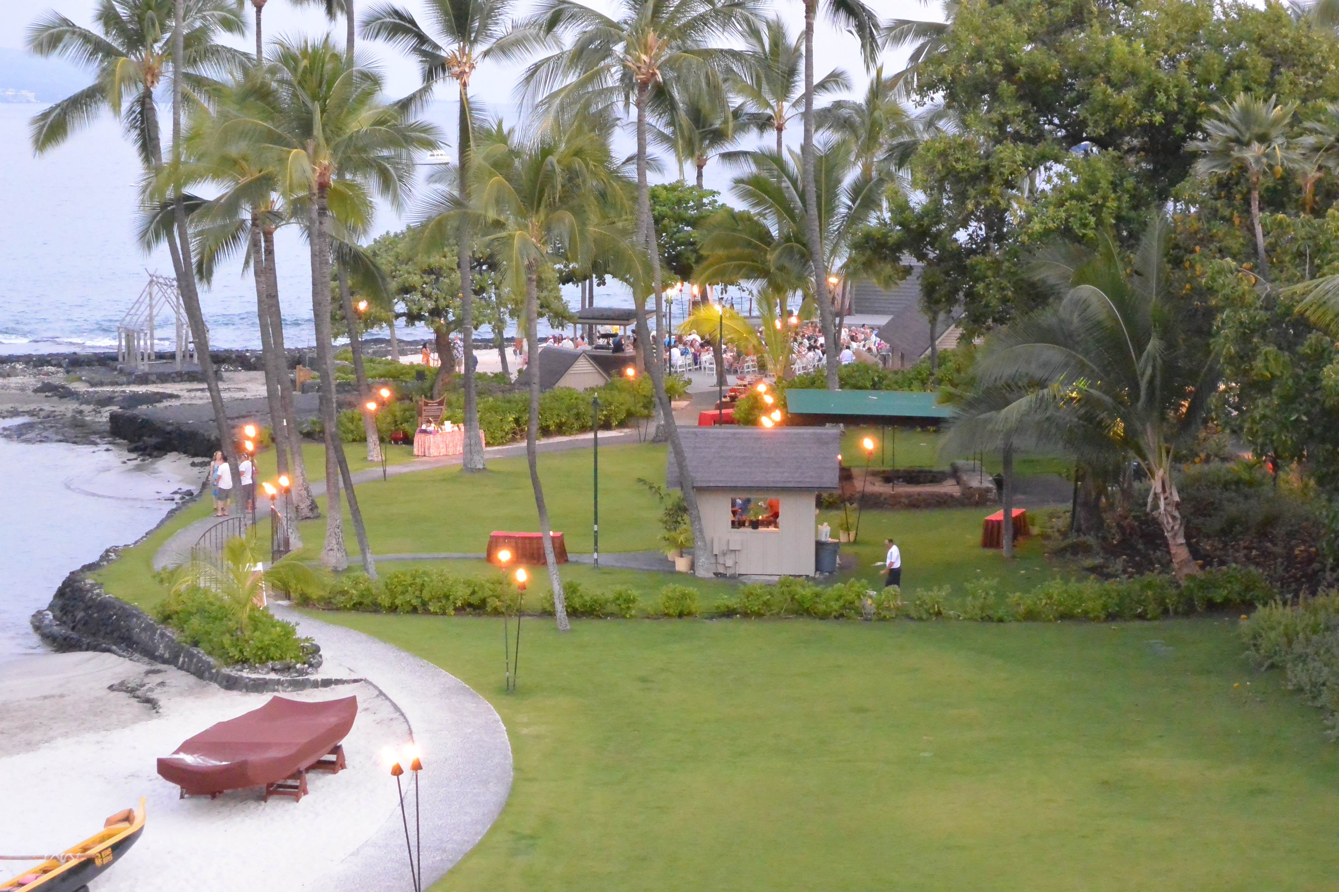
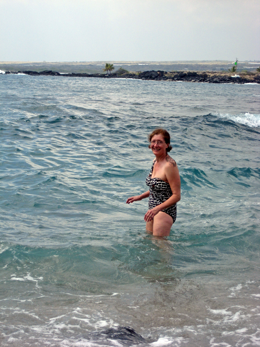
When I last wrote of this trip, we had returned from an unproductive trip waiting in vain to see manta rays. This was the first reason I didn’t get more running in while in Hawai’i. The Big Island Running Company, the running store in Kona, has group runs Tuesday and Thursday at 5 PM, and Saturday at 6:30 AM. I had plans to do the Thursday run, but in order to get to our manta ray trip, I had to skip it. Their usual run is about a six mile run, typically around an 8:30 pace. The guy in the shop told me an option was to run with him and his friends for a five mile warm up, then hill repeats, and a five mile cool down. I laughed, and said that normally I would take him up on it, but being on vacation I didn’t want to work that hard. It was not an issue anyway, since we needed to get to our manta ray trip.
The next morning, we were heading to the other side of Hawai’i for a zip line tour. There are a number of companies running zip lines in Hawai’i. We selected Skyline Eco-Adventures, because we would be able to zip over waterfalls, and because they were the original zip line company in the U.S., at least according to their web site. They also have a commitment to being “carbon neutral”, and ecologically friendly, which are all good things. They are located on the other side of Hawai’i from Kona, near Hilo, so we would need to rise early in order to drive the two hours to get to the start on time. Fortunately, our breakfast buffet started at 6 AM, and we were there a few minutes after that, fueling up for our adventure. There are just a few ways to drive around the island. There’s the southern route, which is the long way to get to Hilo. There’s Saddle Road, which is the shortest route from Kona to Hilo, but a crazy drive. We were heading to Akaka Falls State Park, which is north of Hilo. So we took the northern route around the island, through Waimea.
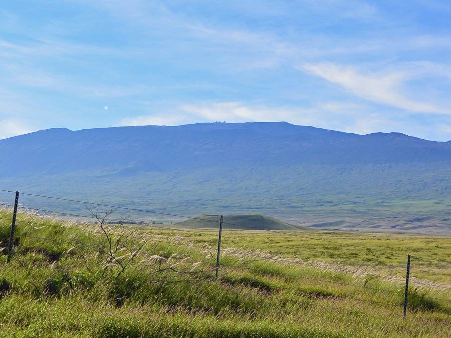
View of Mauna Kea, with observatories visible at the summit, along route 190 heading toward Waimea.
Waimea is home of the Parker Ranch, which is a cattle ranching operation started in 1847 by John Palmer Parker. Early on, the ranch covered 250,00 acres, and grew at one point to 500,000 acres. It is now run by a trust, but still is an active cattle ranching company. Also in Waimea are the support facilities for two of the large telescopes atop Mauna Kea, the Keck Observatory and the Canada-France-Hawaii Telescope. We stopped in Waimea for a coffee at Starbucks. While it seemed practically sacrilegious to buy Starbucks in the home of Kona coffee, I was pleased to see a long line of locals waiting to buy coffee, recognizing, probably, the high cost of the local product. As we drove eastward along the northern part of Hawai’i, the climate changes significantly, going from arid conditions on the west of the island, to the rain forests of the eastern side. We had some rain and fog along this part of the drive. As we got to the turnoff for Akaka Falls, though, the rain stopped and the sun was peeking out. We turned off route 19 to Honomu Road, to the staging office of our zip line company.
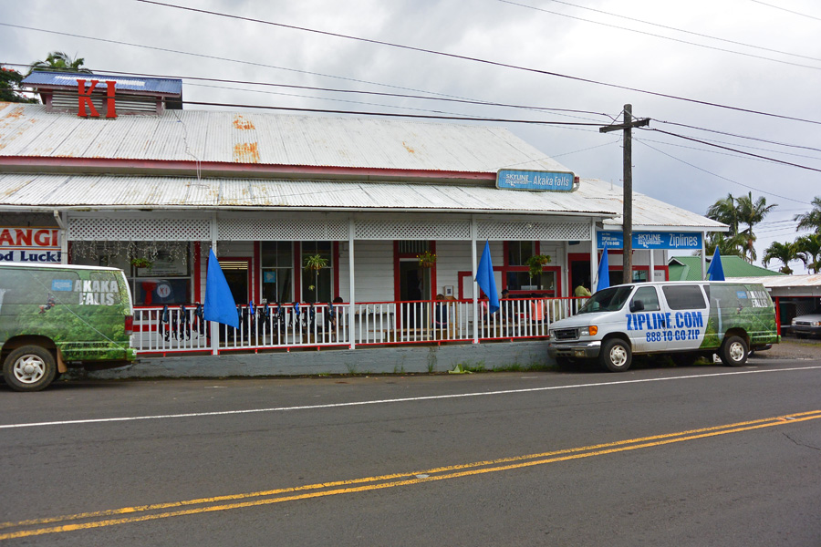
Office of Skyline Eco-Advenures, near Akaka Falls State Park in Hawai’i
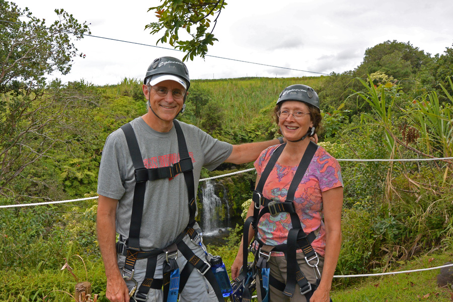
The office is a small, humble one, part of an old building with the other half unoccupied. They seemed very professional and confident, though, so we were not concerned. They have a large tackle box in the office which they call their lock box, and in which one can place items like keys and wallets. It would be unfortunate if items like that slipped out of one’s pocket while zipping a few hundred feet above a gorge. Of course, a clever thief could make off with the whole box, but fortunately, that didn’t happen. The first thing, of course, was to sign the waver holding them blameless for any fate that should befall us. Before heading out, our group of eleven intrepid explorers were fitted with our harnesses. This set of thick nylon straps is the method by which we would be suspended from the zip cable. A few warnings were given. Don’t let your fingers get up to the contraption which has the wheels that zip along the cable. The fingers will go missing. Make sure any items one carries are secured to your person. We were provided with a water bottle (very nice one, by the way, a 700 cc BPA-free bottle with a screw cap, which we attached by a carabiner to our harness. Given the warmth and humidity, the water would be needed.
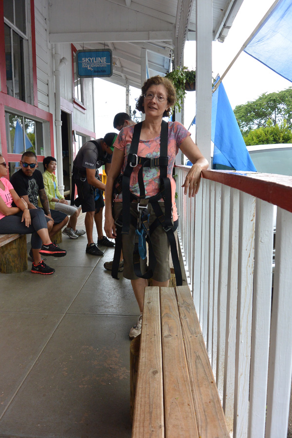
Kat, strapped in to her harness.
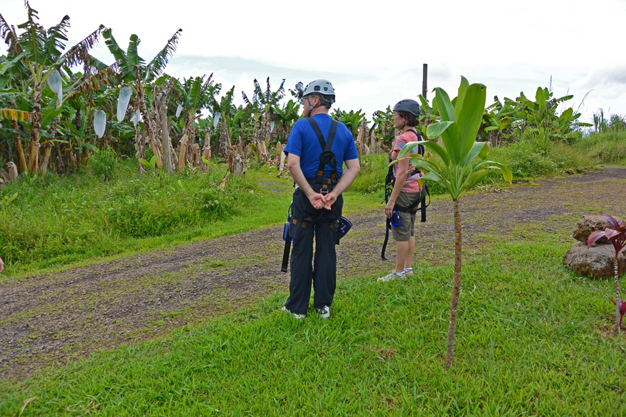
We then piled into a large van for our trip to the starting point. The drive there was an adventure itself. It was primarily over rough dirt roads which climbed through old banana and sugar cane fields. While the bananas are still a viable crop, the sugar cane production is down significantly from it’s peak in the late 1960’s. We had two guides, which is necessary for zip line tours, since you need one to get you going and the other to stop you at the other end. Both of our guides were graduates of agriculture programs in college, and were able to provide us with a wonderful amount of information about the local flora, both native and non-native, and give us samples of local berries and flowers that could be plucked and eaten. Our first zip line was a training line, to get us used to the action.

The training zip line, a little zip before moving on to the long ones.
That done, we headed on to the next line. Each zip line was longer than the last, and higher above the ground. Along the way we got to sample some of the local banana crop, which are primarily the Williams and Apple type. These, until recently, could not be shipped to the mainland due to fruit flies which might travel with them. We were able to pluck them from the tree. They are smaller, and quite a bit sweeter, than bananas back home.
Observing the banana trees along the zip line route.
We learned how to control our position on the zip line. Rotating the clamp holding us to the rollers to the left would cause us to rotate to the right, and vice versa. That way, we could get a look at all the great views under us as we went zipping by. We crossed one set of waterfalls which was very beautiful.
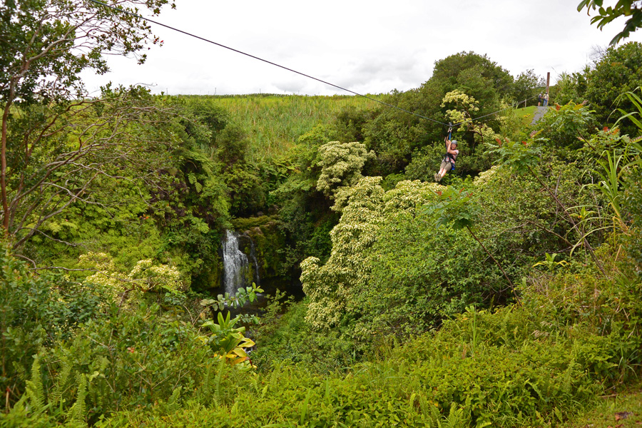
A smaller falls. The big one was yet to come. Kat goes zipping along the cable.
We also found that stretching out flat allows for a faster ride. Between each zip line, there were seven in all, we walked from station to station, examining interesting plants and tasting the odd berry or flower with the urging of our guides.
Kat and Frank, clearly enjoying the zip experience!
When we got to the last of the zip lines, we needed to climb a tall, tower-like structure to start. This was the longest ride, about 3300 feet, and it would take us over Akaka falls.

The tower for the last zip.
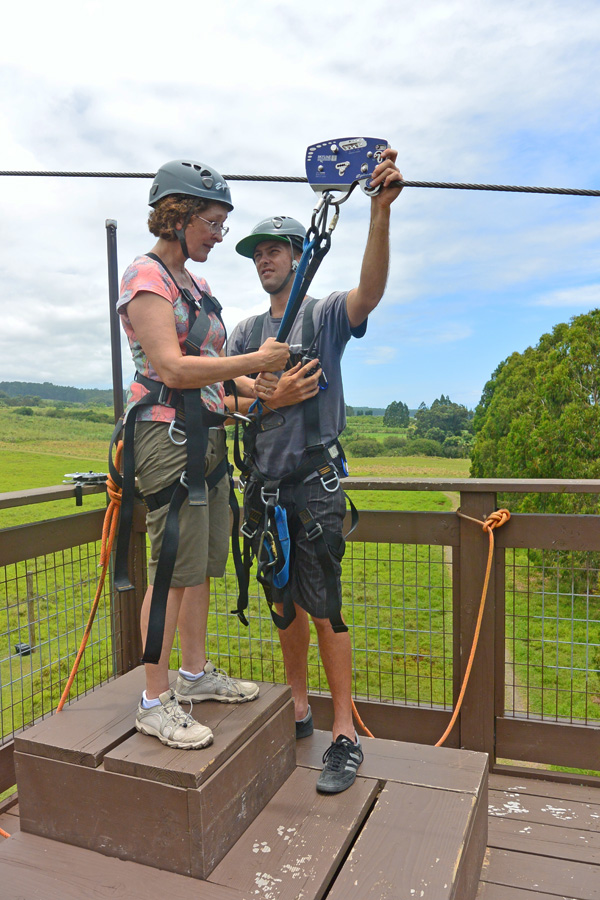
Kat preparing to take off over Akaka Falls.
This would be a long ride, and would have some nice views in the middle. One wouldn’t want to progress too slowly, though, and get hung up midway along the cable. That has happened, according to our guides, and they had to use a special device to go out along the cable and rescue the poor lug. So the word was, keep your speed up, enjoy the view, and we’ll see you on the other side. I readied my camera to capture a picture of the falls as I went over it. Dangling from a cable, twisting, wanting to keep my speed up, I wasn’t sure if I would capture much of a photo. As it turns out, I was able to get a pretty terrific shot of the falls.
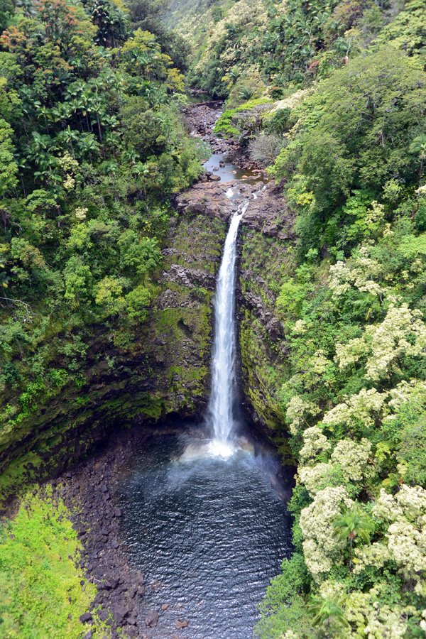
Akaka Falls as seen from the zip line.
We had a fun group, and everyone was fearless from the start. I would not have minded continuing on for several more zips, but unfortunately we had come to the end. We boarded the van for the ride back to the office.

Our fearless group of zip liners.

I think this is Heliconia bihai, or Macaw flower, non-native to Hawaii, but introduced long ago, before the reign of King Kamehameha I
After leaving Skyline Eco-Adventure office, having retrieved our valuables from the secure lock box, we headed off toward Hilo, the county seat of the island of Hawai’i, and the oldest city of the Hawaiian Islands. On the way, we took a scenic detour along the Old Mamalahoa Highway, and found a beautiful view of Onomea Bay.
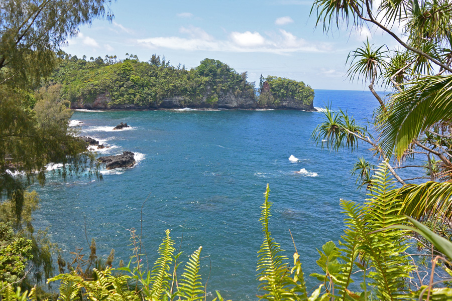
Onomea Bay seen from the Old Mamalahoa Highway.
The dirt path down to the bay was accompanied by these signs:

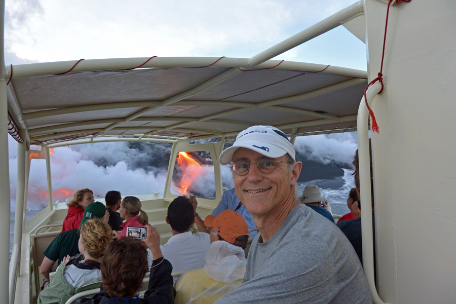
We chose not to venture too far down the path, not out of fear, but because we were heading to our next adventure, the boat ride to see molten lava falling into the sea. We stopped in Hilo for lunch, and found a delightful small cafe called the Puka Puka Kitchen, apparently a favorite of the locals. After lunch, we walked around town a bit to familiarize ourselves with Hilo. It is very much a working community, as opposed to Kona which is very much tourist oriented. The University of Hawai’i is here, as are the Tsunami Museum, and the headquarters for the Mauna Loa Macadamia Nut Corporation. We then headed south, to the southeast point of Hawai’i, at Isaac Hale park, to meet up with our boat which would take us to see flowing lava. The drive was not short, but went through some older communities, with a few papaya plantations along the way. We stopped at Pāhoa, which seems to be where all the hippies from the sixties found a place to their liking. It probably hasn’t changed much in the last 40 or so years. I got some prepared mahi mahi to-go at the local supermarket, for dinner later, and some Maui Bikini Blonde lager, in cans. We made it to Isaac Hale Park with time to spare. This is a park near the water, where there is a small beach, and grassy picnic areas with rest room facilities. A local motorcycle club was wrapping up a get together when we arrived, and other families were enjoying the barbecue grills and playground equipment. We had made reservations with See Lava, a tour boat company we found in “101 Things To Do”, the big island edition. We were surprised when our boat pulled up into the parking lot, on a big trailer. The boat was not small, and was an open air boat with school bus style seats, and two big outboard engines in the rear. They warn you ahead of time, expect the ocean to be rough! Once we had signed, again, the obligatory waver that we would not hold them responsible for any mishap, we were allowed on board, which meant climbing up a rickety ten foot ladder, like a painter might use. My wife and I took seats towards the rear, which, we were told, would be a little less rough than sitting towards the front. The truck hauling the boat maneuvered it back towards the boat ramp at Isaac Hale park. Several small children were swimming where the boat was to be launched. They must have been through this exercise before, since the truck driver just kept heading to the ramp, and the children swam to the side as the boat slipped into the water. Our engines were started, and we were on our way.
Expect the ocean to be rough was an understatement. For the next 45 minutes, our craft pounded along through the waves, with a shudder and a spray of sea water on everyone with each crash over a wave. The fellows managing the boat seemed perfectly comfortable, though, and there was island and volcano themed music coming through the on-board, water-resistant speakers. They had advised everyone to fix feet under the bars, and hold on to something for the trip. It turned out the advice was unnecessary, since not doing so would get you bounced out of the boat. As we approached the viewing area, a sense of awe came over us, as we could see billows of steam rising from where the cliffs met the ocean. Getting even closer, we could start to see the glow of the lava.
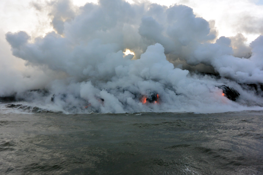
Getting close to the billowing vapor from the lava hitting the ocean water
The source of the lava is the volcano Kilauea, which has been erupting continuously since 1983. The lava rises and falls, and we were fortunate to see it now, while it is at a high point of flow. It didn’t only flow directly into the ocean. It has caused some serious damage to small towns in the path of the lave flow, completely destroying one subdivision called Royal Gardens, and cutting off access to a town called Kalapana. Many homes and businesses are buried under 80 feet of lava.

Partial view of the boat that would bring us closer to the lava flow
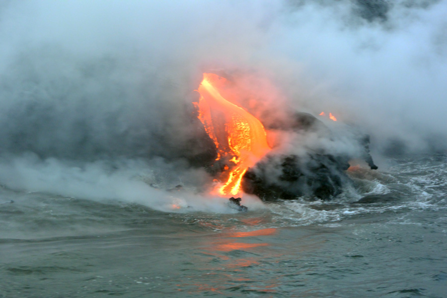
We really started to move in closer to the action
The closer we got, the more the water was churning,reacting to the flow of molten rock
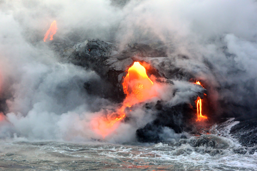
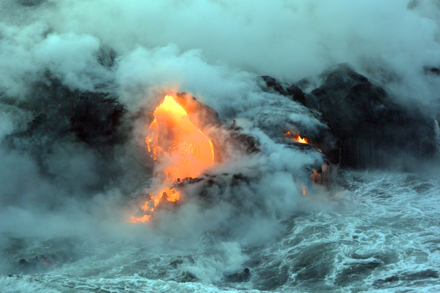
In some areas the lava flowed like a river, in others, it fell as if from a lava faucet
As the lava flowed into the ocean, big chunks of solid rock form which were crackling and popping as they floated around us, trapped air keeping them afloat. The crew hauled a bucket of sea water into the boat so we could feel how hot it was. Indeed, it was very hot, almost scalding.
We were reminded by the crew to put down our cameras and just look at this marvel
After spending about forty five minutes observing the lava flow it was time to head back. Looking high on the overlying shelf we could see about fifty or so people who had hiked out to the cliff edge to observe this phenomenon from high up. They were taking a risk, as the shelf of lava which forms from the flow periodically breaks off, and a few hundred acres can go crashing into the water. Of course, if that were to occur while our boat was nearby, we would probably be boiled alive, too, but, fortunately for us all, we lived to talk about it. This current lava flow reaching the ocean has been active since January of this year. It could redirect, or turn off at any time. The US Geological Survey keeps very detailed records of it’s activity, and updates are published on a daily basis.
After a smashing, wave crashing ride back to Isaac Hale Beach, we were hauled back up on land by a waiting boat trailer, the driver of which expertly collected the boat out of the water without a hitch (bit of nautical wordplay, there). We then, with shaky legs, had to descend that same aluminum ladder we used to climb in to the boat.
Our next adventure was to be a tour of the Volcano National Park by bicycle, the next morning. Since we were already on the side of the island with the National Park, it didn’t make sense to drive all the way back to Kona for the night, only to drive back here again the next morning. We found overnight lodging in a small house turned bed and breakfast, called the Aloha Crater Lodge, located in Volcano, Hawai’i. That will start part III of our big island tour.